How much of Barking and Dagenham is a conservation area?
Very little. The register records four conservation areas covering 22 hectares, the lightest designation in London, and the largest of them — Abbey and Barking Town Centre — accounts for 16 of those hectares on its own. The borough also holds 48 listed buildings.
Measure
Barking and Dagenham
London
Conservation areas (national register)
4
1,141
Designated area
22 ha
—
Listed buildings
48
—
Householder approval
69.7%
83.0%
Decided within 8 weeks
100.0%
—
Householder appeals allowed after refusal
28.9% of 280
40.8% of 13,067
Sources: conservation area counts and boundaries from the planning.data.gov.uk register, retrieved 1 September 2026, with hectares computed from the published boundaries. Decision figures from MHCLG District Planning Application Statistics (PS1 and PS2), twelve quarters to March 2026. Appeals from Planning Inspectorate casework decided 2016–2026. Open Government Licence v3.0.
Where does conservation area cover actually fall in Barking and Dagenham?
Type a postcode into the map below and it will tell you whether that point sits inside one of the borough’s designated boundaries. The shapes are the designations themselves, taken from the national register rather than redrawn from a council leaflet, and the lookup runs in your own browser, so the address does not leave the page. One caution about the edges: the outlines are simplified so they draw quickly, and a property sitting on a boundary line cannot be settled by the drawing. That one needs the council’s definitive map.
Designation in this borough is concentrated, not spread. The whole designated area comes to 21.5 hectares, and roughly three quarters of that is a single place — Abbey and Barking Town Centre, at 16.2 hectares, around the abbey ruins and the old town core. At the other end sits Abbey Road and Riverside, 0.6 hectares of it. The practical reading is that most households here are nowhere near a boundary, and the ones that are, are largely in one part of the map. The register does carry designation dates for the borough, the earliest 10 August 1975 and the most recent 6 December 1995, and every area has a council document attached to it — in this borough the council’s own page for the area, which is where its character appraisal can be found. It also holds three Article 4 direction areas, and those are worth checking even if the map puts you well clear of a conservation boundary: an Article 4 withdraws permitted development rights on its own footprint, quite separately from designation.
Area outlines and Article 4 extents come from the planning.data.gov.uk conservation-area and article-4-direction-area datasets, downloaded 15 August 2026 and checked again on 1 September 2026. Contains public sector information licensed under the Open Government Licence v3.0
In detail
Answers for Barking and Dagenham
How many conservation areas does Barking and Dagenham have?
Barking and Dagenham has 9 designated conservation areas, including Becontree Estate (historic), Eastbury, Valence House.
What changes need planning in a Barking and Dagenham conservation area?
Any external alteration visible from a public space typically requires full planning permission inside a conservation area: roof additions, dormers, replacement windows, rendering, hardstanding, and demolition. Internal works generally do not, unless the property is also listed.
Do I need a Heritage Statement in Barking and Dagenham?
Yes — every application inside a conservation area requires a Heritage Statement. It must address the conservation area character appraisal, identify heritage assets, and explain how the design preserves or enhances character. We prepare this as part of every conservation-area application.
Can I have a roof extension or mansard in a Barking and Dagenham conservation area?
Rear mansards and dormers are routinely approved in many London conservation areas where the design matches the terrace's existing roofscape — particularly in Hackney, Islington, Tower Hamlets, Lambeth and Southwark. Front-facing dormers are almost universally refused.
How long does conservation area approval take in Barking and Dagenham?
Barking and Dagenham Council statutory determination is 8 weeks for householder applications. Conservation officer consultation adds 2–3 weeks in practice. Expect 11–14 weeks from validation to decision.
Planning application setExisting, proposed and location plans on one sheet — as the council receives it through the Planning Portal.
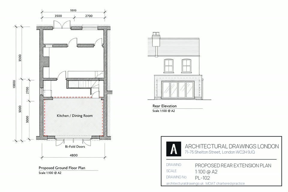
Proposed planExisting footprint in solid hatch, the new rear extension dimensioned against it.
The planning set that goes to the council through the Planning Portal: proposed elevations, plans, and the OS location plan with your site outlined.
Book a call
Speak to a chartered technologist — free 15 minutes
Pick a slot that suits you. No obligation and no sales pressure, just straight answers on your planning route.
Which Barking and Dagenham postcodes does this conservation area application service cover?
Every Barking and Dagenham postcode district we draw in, the stock that dominates
it and the authority that validates a conservation area application there. Barking and Dagenham fees below are the
statutory England rates for 2026, not conservation area application estimates.
Postcode
Area
Dominant stock
What it means for a conservation area application
RM6
Chadwell Heath
1930s semi-detached
RM6 straddles a boundary: Chadwell Heath addresses fall to Barking and Dagenham Council or Redbridge Council, so confirm which authority validates the conservation area application before submitting RM6 drawings.
RM8
Becontree / Dagenham
1920s-30s estate housing (Becontree)
A conservation area application at an RM8 address in Becontree / Dagenham is determined by Barking and Dagenham Council under its own Local Plan policies for Becontree / Dagenham.
RM10
Dagenham
1920s-30s estate housing (Becontree)
RM10 covers Dagenham only; Barking and Dagenham Council handles the conservation area application.
IG11
Barking
Victorian terraces, post-war flats, new-build
IG11 covers Barking only; Barking and Dagenham Council handles the conservation area application.
Which Barking and Dagenham neighbourhoods suit a conservation area application best?
Roof pitch, wall build-up and plot depth change every few Barking and Dagenham
streets, and each one changes what a conservation area application can achieve at that address.
Barking (IG11) — conservation area application work in Barking means victorian terraces, post-war flats, new-build. Barking is Victorian centre, regen riverside. Most applications on these Victorian streets are householder applications validated on existing and proposed plans throughout IG11. Barking and Dagenham Council decides the Barking application, and Barking Town Hall anchors the Barking location plan.
Dagenham (RM8, RM9, RM10) — conservation area application work in Dagenham means 1920s-30s estate housing (becontree). Dagenham is Becontree Estate, 1920s-30s. Post-war stock here frequently sits inside an estate layout throughout RM8. Barking and Dagenham Council decides the Dagenham application, and Dagenham Dock anchors the Dagenham location plan.
Chadwell Heath (RM6) — conservation area application work in Chadwell Heath means 1930s semi-detached. Chadwell Heath is 1930s semi-detached. On these 1930s semis the prior approval route often replaces a full application throughout RM6. Barking and Dagenham Council decides the Chadwell Heath application, and Chadwell Heath station anchors the Chadwell Heath location plan.
Becontree (RM8, RM9) — conservation area application work in Becontree means 1920s-30s estate housing. Becontree is 1920s-30s estate. Post-war stock here frequently sits inside an estate layout throughout RM8. Barking and Dagenham Council decides the Becontree application, and Becontree Tube anchors the Becontree location plan.
Marks Gate (RM6) — conservation area application work in Marks Gate means post-war estate. Marks Gate is post-war estate. Post-war stock here frequently sits inside an estate layout throughout RM6. Barking and Dagenham Council decides the Marks Gate application, and Marks Gate anchors the Marks Gate location plan.
How do conservation areas and Article 4 affect a conservation area application in Barking and Dagenham?
How designation changes a Barking and Dagenham conservation area application: Barking and Dagenham Council’s own list names 9 conservation areas, including Becontree Estate (historic), Eastbury, Valence House. Inside any of them a Barking and Dagenham conservation area application cannot rely on permitted development, and the route becomes a £548 householder application determined in 8 weeks rather than a £249 prior approval in 6 weeks. Eastbury sets the tone for Barking and Dagenham casework.
Article 4 and your Barking and Dagenham conservation area application: Barking and Dagenham Council has made no borough-wide direction, so permitted development for a conservation area application in Barking and Dagenham generally survives outside Barking and Dagenham conservation areas and listed curtilages. A Lawful Development Certificate at £274 is how a RM6 owner records that a conservation area application was lawful.
The building fabric around Barking and Dagenham: Becontree Estate (the world's largest council estate when built, 1920s-30s) dominates; post-war estates around Barking town; new-build riverside. Major regeneration in Barking Riverside; mostly permissive planning outside conservation pockets. A conservation area application in Barking and Dagenham is scoped against that stock first.
Who decides a conservation area application on the edge of Barking and Dagenham?
Havering — the Havering boundary runs against Barking and Dagenham, so a conservation area application a street from Barking and Dagenham is decided by Havering Council instead. Havering runs 15 conservation areas across RM1 and its neighbours, which is why conservation area applications priced for Barking and Dagenham are re-checked against Havering policy whenever the Barking and Dagenham address sits on that edge.
Redbridge — the Redbridge boundary runs against Barking and Dagenham, so a conservation area application a street from Barking and Dagenham is decided by Redbridge Council instead. Redbridge runs 14 conservation areas across E11 and its neighbours, which is why conservation area applications priced for Barking and Dagenham are re-checked against Redbridge policy whenever the Barking and Dagenham address sits on that edge.
Newham — adjoining Barking and Dagenham, with 10 conservation areas centred on E6. A conservation area application on the far side of the Barking and Dagenham line is determined by Newham Council, so the Barking and Dagenham quote for conservation area applications is checked against Newham guidance before it is issued.
Sources for this Barking and Dagenham conservation area application page: borough policies maps and
conservation-area registers (2025–26), Royal Mail postcode district boundaries,
the Town and Country Planning (Fees for Applications) (England) Regulations, the Town
and Country Planning (General Permitted Development) (England) Order 2015 as amended,
and the Party Wall etc. Act 1996.
A london terraced street of the type we survey — conservation area planning in Barking and Dagenham.