
Measured Building Surveys · SW16 Streatham
SW16 spans Lambeth and Croydon; Lambeth controls the Telford Park and Leigham Court conservation areas around Streatham.

Three of them. SW16 spans Croydon, Lambeth and Merton, and their records diverge: Croydon approved 81.6% of householder applications, Lambeth 80.1% and Merton 88.9%. Lambeth also carries 223 Article 4 areas against Croydon’s none in the register. Merton delegates 99.3% of decisions, second only to Redbridge.
| Measure | Croydon | Lambeth | Merton |
|---|---|---|---|
| Householder approval rate | 81.6% | 80.1% | 88.9% |
| Decided inside eight weeks | 93.4% | 95.2% | 91.4% |
| Article 4 areas in the register | not recorded | 223 | not recorded |
| Conservation areas | 20 | 65 | 28 |
| Lawful development certificates issued | 1,699 | 1,138 | 156 |
| Measured survey, floor plans from | £245 | £245 | £245 |
Sources: decision figures from MHCLG District Planning Application Statistics (PS1 and PS2), twelve quarters to March 2026; registers from the MHCLG Planning Data Platform, retrieved 1 September 2026 — 'not recorded' means the register has not been uploaded; the survey fee is our own published fixed fee.
Streatham SW16 — local contextLooking at the borough as a whole instead of this one district? See measured building surveys in Lambeth.
A measured survey records the building as it stands, wall by wall, with every opening, level and boundary, and everything drawn afterwards sits on that record. Right angles are scarce in the older SW16 terraces and villas, and one assumed in Streatham or Furzedown becomes a steel beam that will not fit. Laser measurement removes that risk before a council ever opens the file.
BLK360 point-cloud scanning and Leica Disto measurement, issued in Revit and AutoCAD, from an MCIAT chartered practice.
Across Streatham, Norbury, Streatham Hill, Furzedown in SW16, the dominant property is victorian and edwardian terraces and bay-fronted semis, with mansion blocks and larger villas around streatham and norbury. That stock shapes what measured building survey looks like here: the right approach for a period terrace differs from a mansion-block flat or a new-build, and Lambeth Council judges each on design quality and neighbour impact. We survey the specific Streatham property, confirm the planning route — Permitted Development, a Lawful Development Certificate, or full planning — and draw a council-ready set tailored to the SW16 streetscape.
Housing stock in SW16: Victorian and Edwardian terraces and bay-fronted semis, with mansion blocks around Streatham Hill and larger villas near Streatham Common and Norbury.
Within the district: Streatham, Norbury, Streatham Hill, Furzedown.
Streets we know in SW16: the Streatham Hill and Telford Park roads, Mount Ephraim Lane and the Furzedown streets. Each road has its own building line, boundary treatment and precedent that Lambeth Council weighs when assessing a measured building survey scheme.
Conservation areas: Telford Park, Streatham Lodge and Leigham Court are the SW16 designations. Within their boundaries a heritage statement and a full application are the norm for anything visible outside.
Getting around SW16: Streatham, Streatham Hill and Streatham Common stations run to Victoria and to London Bridge.
Regeneration: the Streatham town centre programme sits alongside much of SW16 and shapes what local policy expects of design on and near the High Road.
Property values: the Land Registry recorded 978 SW16 sales during 2025 at a median of £467,500. Source: HM Land Registry Price Paid Data. That is the figure to size a scheme against, rather than the flat-and-house ranges that circulate online with nothing behind them.
Local character: dense Victorian and Edwardian streets with post-war estates threaded through them, heavy conservation area coverage, and decisions that hinge on design detail more than on the principle of building. Borough-wide, 36.6% of Lambeth's 148,600 dwellings were built before 1900 (VOA, 31 March 2025).
A chartered technologist attends the Streatham address with a BLK360 scanner and a Leica Disto. Two or three bedroom terraces are usually done inside 90 minutes.
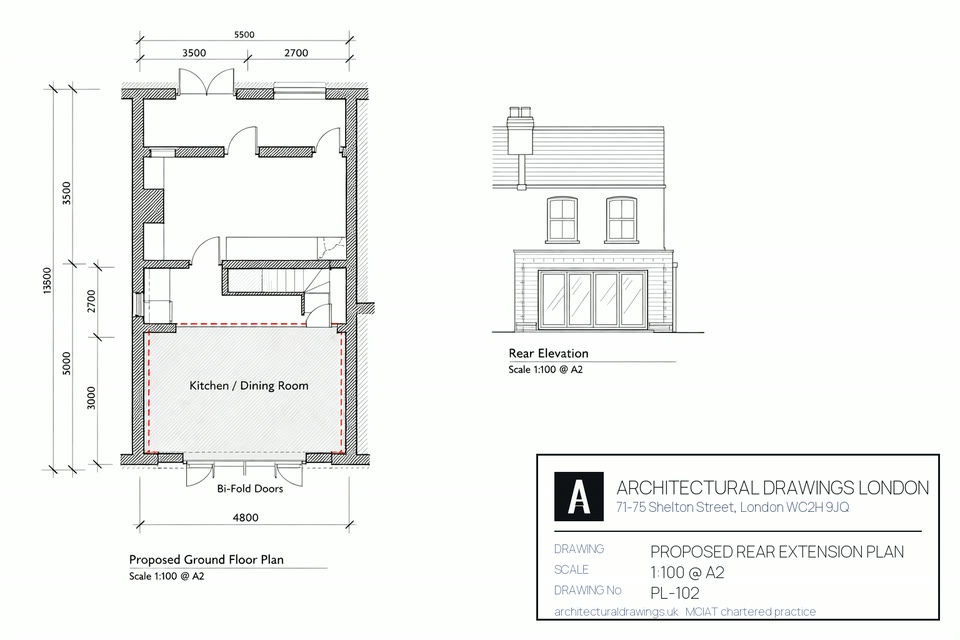
Scales of 1:50 and 1:100, drafted in Revit or AutoCAD, accurate to plus or minus 3mm point to point. Every room, opening, fitting and service annotated.
All four elevations plus cross-sections. Planning wants them, a party wall award wants them, and structural design cannot begin without them.
Point-cloud output from the BLK360 earns its keep on SW16's older villas, on listed fabric, and anywhere the geometry refuses to be square.
Exports come as DWG, RVT, IFC and PDF, so the same model opens for your architect, your structural engineer and the contractor.
An RICS-compliant accuracy report ships with the drawings: accurate to plus or minus 3mm point to point, and 5mm absolute. That is what an insurer, a council or a party wall surveyor signs against.
Single planning or building-regs submission.
Planning + building regs + structural.
Listed, conservation or complex sites.

Yes. The bay-fronted terraces and semis around Telford Park and Furzedown take side-return and rear extensions, and lofts, and much of that sits inside permitted development once you are outside the conservation areas. A Lawful Development Certificate puts it beyond argument. The route gets settled first; the drawings then follow whichever council's validation checklist applies.
SW16 crosses three boundaries, not one. Streatham and Streatham Hill are Lambeth. Norbury is Croydon. Furzedown is Wandsworth, and the far end towards Streatham Vale touches Merton. Those councils run different designations and different householder policies, so the authority is confirmed against the address before we quote and before anything is lodged.
Usually yes — a hip-to-gable plus rear dormer on the semis, within the volume allowance and confirmed by a Lawful Development Certificate, provided you're not in the Telford Park or Leigham Court conservation areas. We check the constraints for your road and draw it for Building Control.
Space, yes. Value, we cannot tell you, because no dataset held in this practice attributes a price uplift to a rear extension or a loft. What SW16 does offer is a well-supplied market, 978 sales recorded through 2025, and stock that takes a side return or a rear dormer without much of a fight, provided the drawings are right.
Set the drawing fee against the property. HMLR's 2025 price-paid returns for SW16 give a median sale of £467,500 over 978 transactions, so a professional survey and drawing package is a low single-digit percentage of the asset. The council's own charge comes on top and is set nationally. The householder application fee in England is £548. A full application is £610. Our drawings carry one fixed price. The site survey is free, at any address in the district.
Instruction to submission on an SW16 job runs 3 to 4 weeks: the survey in week one, then two weeks of drawings and amendments, and after that validation plus the statutory 8 weeks. What follows depends on which council holds it. Lambeth decided 993 of 1,043 householder applications inside eight weeks over twelve quarters to March 2026, with only three running past thirteen weeks, though two of its slower bands read zero and a zero in these returns can mean nothing was recorded rather than nothing happened. Croydon, which covers the Norbury end, decided 1,659 of 1,777 inside eight weeks but let 49 run beyond thirteen. Source: MHCLG live planning statistics. Either way, every officer query comes back to us rather than to you.
SW16 is not one council's territory. Just under two thirds of the district's recorded property sales sit in Lambeth, Streatham and Streatham Hill among them, while Norbury runs into Croydon, Furzedown into Wandsworth, and the Streatham Vale fringe into Merton. Whichever authority applies, an Article 4 direction may be in force, and the SW16 conservation areas, Telford Park, Streatham Lodge and Leigham Court, all require full planning and a heritage statement. We fix the authority against your exact address before quoting.
Almost always. Structural work behind the survey, new openings, steel beams, loft floors or foundations, cannot avoid the building regulations. Three parts carry a job like this: L on insulation, A on holding the house up, and B on the way out if there is a fire. Sign-off comes from council building control, or from an approved inspector instead. SW16 is mostly terraced and semi-detached, so notice under the Party Wall Act usually has to reach the neighbours before the steel goes in. Both are coordinated inside the Complete package.
Nothing in the published data attributes a resale uplift to an extension or a loft, and we are not going to invent one. What can be said is this: HMLR's 2025 SW16 median of £467,500, across 978 recorded sales, tells you the order of magnitude the property sits at, and a drawing package is a small fraction of it. The measurable risk runs the other way: work built with no permission behind it, or no building control sign-off, is exactly what a buyer's solicitor turns up.
Pick a slot that suits you. No obligation and no sales pressure, just straight answers on your planning route.
The SW16 neighbourhoods we draw in, what each one is built from, and which of the four councils validates work there. Fee figures given are England's statutory 2026 application rates. A survey and drawing package is quoted separately from them.
| Postcode | Area | Dominant stock | What it means for a measured building survey |
|---|---|---|---|
| SW16 | Streatham / Norbury | Edwardian terraces, post-war flats | SW16 is shared. A Streatham or Norbury address can be determined by Lambeth, Croydon, Merton or Wandsworth, so it gets checked against the relevant policies map before submission. |
| SW16 | Streatham | Edwardian terraces, post-war flats | Streatham proper sits in SW16 and in Lambeth, so a survey drawn for a Streatham application goes to Lambeth. |
| SE11 | Kennington / Vauxhall | Georgian terraces, post-war estates | Adjoining district to SW16. A survey is a record rather than an application, so nothing about it changes at the Lambeth boundary. |
| SE24 | Herne Hill | Victorian villas, Edwardian terraces | Adjoining district to SW16. A survey is a record rather than an application, so nothing about it changes at the Lambeth boundary. |
| SE27 | West Norwood / Tulse Hill | Victorian terraces, Edwardian villas | Adjoining district to SW16. A survey is a record rather than an application, so nothing about it changes at the Lambeth boundary. |
| SW2 | Brixton Hill / Tulse Hill | Victorian terraces, post-war estates | Adjoining district to SW16. A survey is a record rather than an application, so nothing about it changes at the Lambeth boundary. |
| SW11 | Battersea / Clapham Junction | Victorian terraces, mansion blocks | Adjoining district to SW16. A survey is a record rather than an application, so nothing about it changes at the Wandsworth boundary. |
| SW12 | Balham | Victorian and Edwardian terraces | Adjoining district to SW16. A survey is a record rather than an application, so nothing about it changes at the Wandsworth boundary. |
| SW15 | Putney / Roehampton | Edwardian terraces, Victorian villas, mansion blocks | Adjoining district to SW16. A survey is a record rather than an application, so nothing about it changes at the Wandsworth boundary. |
| SW17 | Tooting / Earlsfield | Edwardian terraces | Adjoining district to SW16. A survey is a record rather than an application, so nothing about it changes at the Wandsworth boundary. |
Bay depth, wall build-up and roof pitch shift street by street through SW16, and a survey that guesses at any of the three puts the error into every drawing that follows.
SW16 designations on the Lambeth side: three Lambeth conservation areas fall inside this district, Telford Park, Streatham Lodge and Leigham Court. Herne Hill, Brixton Road, Kennington and Brockwell Park are Lambeth designations as well, but they belong to SE24, SW9 and SE11, and none of them touches SW16. Inside a designation the prior approval route drops away and a householder application takes its place. The householder application fee in England is £548, and the decision period is eight weeks. The fee for a larger householder prior approval is £249.
Article 4 and your SW16 (Streatham / Norbury) measured building survey: Borough-wide Article 4 for HMO conversions; plus office-to-residential restrictions. At a SW16 address that matters twice over, because Lambeth Council applies the direction unevenly across SW16 (Streatham / Norbury) — we read the SW16 (Streatham / Norbury) policies map for the exact SW16 address before quoting measured building surveys.
What SW16 is built from: Victorian and Edwardian terraces through Streatham and Streatham Hill, bay-fronted semis around Furzedown and Streatham Park, interwar and post-war housing towards Norbury and Streatham Vale, and mansion blocks along the main roads. Clapham, Brixton, Herne Hill and Kennington are not in SW16, whatever other pages say. What the house is made of drives both the survey and the consent route, far more than the postcode on the deeds, and a case officer reads it first. The householder application fee in England is £548, paid to whichever of the four councils validates the application, with eight weeks to a decision.
SW16 designations on the Wandsworth side: Wandsworth's share of SW16 is Furzedown. The Wandsworth designations that other pages attach to this district, Tonsley, Nightingale Triangle, Wandsworth Common, Clapham Common West, all sit elsewhere in that borough and none of them reaches here. Whichever designation does cover a plot, it closes the permitted-development shortcut, and a full application replaces the prior approval you would otherwise have used. The householder application fee in England is £548, over 8 weeks. The fee for a larger householder prior approval is £249, over 6 weeks, and it is not available on Article 1(5) land.
Article 4 and your SW16 (Streatham / Norbury) measured building survey: Article 4 for HMO conversions covering the whole borough. At a SW16 address that matters twice over, because Wandsworth Council applies the direction unevenly across SW16 (Streatham / Norbury) — we read the SW16 (Streatham / Norbury) policies map for the exact SW16 address before quoting measured building surveys.
What SW16 (Streatham / Norbury) is built from: Extensive Victorian terraced streets — the classic London side-return extension opportunity; Edwardian villas around the commons; 1930s semi-detached in Southfields. Family-oriented, high side-return extension and loft conversion rates; planning department experienced with Victorian terrace modifications. That mix decides the measured building survey route in SW16 (Streatham / Norbury) more than the postcode does, and it is what a Wandsworth Council case officer reads first. A householder application costs £548 paid to Wandsworth Council direct, with 8 weeks to a decision once validated.
Sources for this SW16 measured building survey page: borough policies maps and conservation-area registers (2025–26), Royal Mail postcode district boundaries, the Town and Country Planning (Fees for Applications) (England) Regulations, the Town and Country Planning (General Permitted Development) (England) Order 2015 as amended, and the Party Wall etc. Act 1996.
Free fixed quote in 60 seconds. MCIAT chartered.
Get my free quote →Or contact us about your project firstYou can search by service or borough to find the right fit, or open a client account to track your project. When you are ready, get a quote today — most homeowners have a fee in minutes — or contact us about your project and a chartered technologist will be in touch.

