
Measured Building Surveys · E11 Leytonstone
Redbridge and Waltham Forest both touch E11; conservation control is strongest around Wanstead Village and Bushwood.

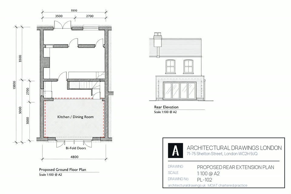
Redbridge for Wanstead and Snaresbrook, Waltham Forest for parts of Leytonstone — and the two differ sharply. Redbridge has no Article 4 areas in the national register; Waltham Forest has 807, more than any other London borough. Redbridge also issued 2,336 lawful development certificates, second only to Barnet.
| Measure | Redbridge | Waltham Forest |
|---|---|---|
| Article 4 areas in the register | not recorded | 807 |
| Householder approval rate | 81.8% | 77.1% |
| Decided inside eight weeks | 95.9% | 89.4% |
| Lawful development certificates issued | 2,336 | 1,804 |
| Conservation areas | 19 covering 662 ha | 15 covering 140 ha |
| Measured survey, floor plans from | £245 | £245 |
Sources: registers from the MHCLG Planning Data Platform, retrieved 1 September 2026, excluding revoked entries — 'not recorded' means none has been uploaded, never that none exists; decision figures from MHCLG PS1 and PS2, twelve quarters to March 2026; the survey fee is our own published fixed fee. The first thing an E11 survey settles is which authority determines the application.
Leytonstone E11 — local contextThis page deals with one district. The borough-wide view — fees, timescales, and where the council currently stands — is set out at measured building surveys in Waltham Forest.
A measured survey records the Leytonstone property as it stands — walls, openings, levels, boundaries — and that record is the base everything else is designed on. Across E11's older terraces and villas at Leytonstone, Wanstead, Snaresbrook and Bushwood, walls are seldom square and floors seldom level; laser measurement catches that long before a case officer opens the file.
Leica Disto laser measurement, BLK360 point-cloud scanning, delivery in AutoCAD and Revit, and MCIAT chartered status standing behind the drawings.
Across Leytonstone, Wanstead, Snaresbrook, Bushwood in E11, the dominant property is victorian and edwardian terraces around leytonstone, with larger houses and the conservation streets of wanstead and snaresbrook. That stock shapes what measured building survey looks like here: the right approach for a period terrace differs from a mansion-block flat or a new-build, and Waltham Forest Council judges each on design quality and neighbour impact. We survey the specific Leytonstone property, confirm the planning route — Permitted Development, a Lawful Development Certificate, or full planning — and draw a council-ready set tailored to the E11 streetscape.
Housing stock in E11: Victorian and Edwardian terraces through Leytonstone, then larger houses and the conservation streets at Wanstead and Snaresbrook.
Within the district: Leytonstone, Wanstead, Snaresbrook, Bushwood.
Streets we know in E11: the Bushwood and Hollybush Hill streets, the Wanstead High Street area and the Leytonstone terraces. Each road has its own building line, boundary treatment and precedent that Waltham Forest Council weighs when assessing a measured building survey scheme.
Conservation areas: Wanstead Village, Bushwood, and Matcham at Leytonstone. Inside any of the three, external work of almost any kind means a full application supported by a heritage statement, because the designation is precisely what removes the permitted route.
Getting around E11: Central line at Leytonstone and Snaresbrook, plus Leytonstone High Road on the Overground.
Regeneration: Leytonstone town centre sits on top of, or immediately beside, much of E11, and the policies written for it shape frontages and the design expectations applied to housing nearby.
Property values: the price-paid returns give E11 a 2025 median of £590,000 over 601 completed sales, which is the fairest single gauge of what property in the district is worth.
Borough character: Walthamstow Village carries a conservation area designation, and tight design control comes with it. Away from designated ground, Waltham Forest has been receptive to side-return extensions.
A chartered technologist comes to the Leytonstone address with laser and scanner in the bag — Leica Disto, BLK360. Ninety minutes covers the typical two or three-bedroom terrace around here.
Output is AutoCAD or Revit, plotted at 1:50 where detail matters and 1:100 where it does not, held inside 3mm. Openings, fittings and service runs are annotated, never implied.
Four elevations and cross-sections come as standard. Planning needs the building in the vertical; so does the structural design; so does any award drawn up between neighbouring owners.
The BLK360 produces a point cloud of the entire property, which is what you want on E11's period stock, on listed buildings, and anywhere the geometry refuses to behave itself.
Exports cover DWG, RVT, PDF and IFC formats. Whoever takes the job on next works from the model itself rather than from a scan of a printout.
An accuracy statement in RICS form comes with it: 3mm between any two points, 5mm across the building as a whole. That satisfies the council, the insurer, and the party wall surveyor drafting an award between owners.
Single planning or building-regs submission.
Planning + building regs + structural.
Listed, conservation or complex sites.

Yes. The terraces around Leytonstone and the bigger houses at Wanstead take side returns, rear extensions and loft work well, and away from the conservation areas much of it counts as permitted development — which a Lawful Development Certificate puts beyond argument. One caution about the prior-approval route for a larger rear extension: Waltham Forest refused 280 of the 736 it decided over the twelve quarters to March 2026, which is 38.0% against 24.9% for London pooled, and against 20.9% in Redbridge on the other side of the district. We confirm the route and draw to the right council's checklist.
E11 straddles a boundary. Leytonstone is Waltham Forest; Wanstead and Snaresbrook are Redbridge. On the 2025 sales, 63.7% of transactions in the district fell to Waltham Forest — a clear majority, and nothing remotely like all of it. The two councils apply different conservation and householder controls, so the authority gets confirmed before we quote, and the submission is built to that council's checklist.
Wanstead Village and Bushwood are conservation areas protecting the Georgian and Victorian frontages around the High Street and George Green. External change there means a full application with heritage justification attached. Wanstead is in Redbridge, so that one goes to Redbridge officers; an address a mile west in Leytonstone does not. We design to the designation and submit to whichever authority actually holds it.
Central line stations at Leytonstone and Snaresbrook are a large part of why the district holds its value: 601 sales completed here in 2025 at a median of £590,000, on the Land Registry's own returns. What a side return or a loft buys is family space, in a place where family space is what people are buying.
Price-paid records put the E11 median at £590,000 across 601 sales in 2025, and against that the drawing fee is a small proportion — this being a district mostly built as Victorian and Edwardian terraces around Leytonstone. The council's own charge sits on top of that: £548 where the application is a householder one, rising to £610 for a full application. What we charge for drawings is fixed at the outset, and nobody pays for the site visit.
On an E11 job at Leytonstone, Wanstead, Snaresbrook or Bushwood, reckon on three or four weeks between instruction and a lodged application. Week one is the survey. Drawings and your revisions fill the fortnight after it, and then comes validation and the statutory eight weeks for a householder decision. Which authority runs that clock depends on the address — Waltham Forest for Leytonstone, Redbridge for Wanstead and Snaresbrook. Anything the case officer raises is answered by us, all the way to the decision notice.
Most of E11 is Waltham Forest, but not all of it: 63.7% of the district's 2025 property sales were inside that borough and the remainder were in Redbridge, so which council you are dealing with is a question rather than an assumption. Article 4 cover is in force in Waltham Forest. Designations within E11 include Wanstead Village, Bushwood and Matcham at Leytonstone, and inside those a heritage statement accompanies a full application. The authority for the exact address gets confirmed before we quote.
Almost always. Cut an opening, drop in a beam, build a loft floor up or go anywhere near the foundations, and the work falls under the Building Regulations — structure, escape and insulation, which is Parts A, B and L. Two people can sign it off: Waltham Forest's building control service, or a private approved inspector. And because this district is mostly terraces and semis, notice under the Party Wall Act generally goes next door before any steel arrives. The Complete package covers both.
In value terms, probably. What can actually be evidenced is the Land Registry's price-paid record for E11: a median sale of £590,000 across 601 transactions in 2025. No public dataset splits that figure between extended and unextended houses, so treat confident claims about uplift with suspicion. The risk that can be measured runs the other way — an unapproved or non-compliant scheme, which is what validated drawings and a clean Building Control record exist to prevent.
Extensions on a boundary plot can involve two authorities. Everything we draw and submit is listed for E4, E10 and E17.
Pick a slot that suits you. No obligation and no sales pressure, just straight answers on your planning route.
The parts of E11 we survey, what each of them is built from, and which of the two authorities validates work there. The fee column holds 2026 statutory England application charges — council money, not survey money.
| Postcode | Area | Dominant stock | What it means for a measured building survey |
|---|---|---|---|
| E11 | Leytonstone / Wanstead / Snaresbrook | Victorian terraces, Edwardian villas | A survey at Leytonstone, Wanstead or Snaresbrook may end up with Waltham Forest or with Redbridge, since E11 crosses between the two and the boundary is read off the policies map street by street. |
| E11 | Leytonstone | Victorian terraces, Edwardian villas | Leytonstone lies in E11 and in Waltham Forest, so a survey drawn for submission from there goes to Waltham Forest Council. |
| E11 | Wanstead | Edwardian villas, 1930s semi-detached | Wanstead is E11 but Redbridge, so proposals resting on a survey there are determined by Redbridge Council. |
| E11 | Snaresbrook | Edwardian villas | Snaresbrook is likewise E11 and Redbridge; anything submitted off a survey there is Redbridge's to decide. |
| E4 | Chingford / Highams Park | 1930s semi-detached, Edwardian villas | Adjoining district to E11. A survey is a record rather than an application, so nothing about it changes at the Waltham Forest boundary. |
| E10 | Leyton | Victorian terraces | Adjoining district to E11. A survey is a record rather than an application, so nothing about it changes at the Waltham Forest boundary. |
| E17 | Walthamstow | Victorian terraces | Adjoining district to E11. A survey is a record rather than an application, so nothing about it changes at the Waltham Forest boundary. |
| E18 | South Woodford | Edwardian villas, 1930s semi-detached | Adjoining district to E11. Surveying needs no consent here either — Redbridge has no say in it, and the survey is the same record whichever side of the line the property sits. |
| IG1 | Ilford Central | Edwardian terraces, post-war flats | Adjoining district to E11. Surveying needs no consent here either — Redbridge has no say in it, and the survey is the same record whichever side of the line the property sits. |
| IG2 | Gants Hill / Newbury Park | 1930s semi-detached | Adjoining district to E11. Surveying needs no consent here either — Redbridge has no say in it, and the survey is the same record whichever side of the line the property sits. |
| IG3 | Seven Kings | mixed stock | Adjoining district to E11. Surveying needs no consent here either — Redbridge has no say in it, and the survey is the same record whichever side of the line the property sits. |
Pitch, wall build-up and plot depth vary within a few E11 streets, and each variation changes what a survey has to pick up before any design starts.
E11 (Leytonstone / Wanstead / Snaresbrook) conservation designations: Waltham Forest's own register lists 17 areas, Highams Park, Walthamstow Village and Lloyd Park included. What designation takes away is the permitted route: instead of a £249 prior approval application decided inside 6 weeks, the work then needs a £548 householder application running 8 weeks, with a heritage statement behind it.
Article 4 and your E11 (Leytonstone / Wanstead / Snaresbrook) measured building survey: Article 4 for HMO conversions in key residential streets. At a E11 address that matters twice over, because Waltham Forest Council applies the direction unevenly across E11 (Leytonstone / Wanstead / Snaresbrook) — we read the E11 (Leytonstone / Wanstead / Snaresbrook) policies map for the exact E11 address before quoting measured building surveys.
E11 (Leytonstone / Wanstead / Snaresbrook) housing stock: Victorian terraces across Walthamstow, Leyton and Leytonstone; 1930s semi-detached in Chingford and Highams Park; post-war flats around Walthamstow Central. Walthamstow Village is a designated conservation area with tight design controls; rest of borough is generally permissive with active side-return extension approvals. Read that before choosing a measured building survey route in E11 (Leytonstone / Wanstead / Snaresbrook) — construction, not postcode, sets what is achievable. Waltham Forest Council charges £548 for a householder application and has 8 weeks to determine it.
E11 (Leytonstone / Wanstead / Snaresbrook) conservation designations: on the Redbridge side of the district that council's register runs to 14 areas, Woodford Green, Wanstead Village and Snaresbrook among them. The consequence is identical wherever the boundary falls: no prior approval at £249 in 6 weeks, but a £548 householder application determined over 8 weeks. On the larger-householder prior approvals each council did decide across those twelve quarters, Redbridge refused 20.9% and Waltham Forest 38.0%.
Article 4 and your E11 (Leytonstone / Wanstead / Snaresbrook) measured building survey: Redbridge Council has made no borough-wide direction, so permitted development for a measured building survey in E11 (Leytonstone / Wanstead / Snaresbrook) generally survives outside E11 (Leytonstone / Wanstead / Snaresbrook) conservation areas and listed curtilages. A Lawful Development Certificate at £274 is how a E11 owner records that a measured building survey was lawful.
E11 (Leytonstone / Wanstead / Snaresbrook) housing stock: 1930s semi-detached dominates outer Redbridge; Edwardian terraces and villas in Wanstead and South Woodford; post-war estates in Ilford central. Outer London suburban; permitted development used heavily for loft conversions and single-storey rear extensions. Read that before choosing a measured building survey route in E11 (Leytonstone / Wanstead / Snaresbrook) — construction, not postcode, sets what is achievable. Redbridge Council charges £548 for a householder application and has 8 weeks to determine it.
Sources for this E11 measured building survey page: borough policies maps and conservation-area registers (2025–26), Royal Mail postcode district boundaries, the Town and Country Planning (Fees for Applications) (England) Regulations, the Town and Country Planning (General Permitted Development) (England) Order 2015 as amended, and the Party Wall etc. Act 1996.
Free fixed quote in 60 seconds. MCIAT chartered.
Get my free quote →Or contact us about your project firstYou can search by service or borough to find the right fit, or set up your account to track your project. When you are ready, get a quote for your project — most homeowners have a fee in minutes — or contact us and a chartered technologist will be in touch.

