020 7864 7245 [email protected] WhatsApp

Architectural Drawings Across the M25 Commuter Belt

MCIAT chartered architectural technology across 30 commuter towns within our 50-mile service radius from London. Planning permission, building regulations, loft conversions, extensions and mansard roofs.


Get a free quote → All London boroughs
Commuter Belt30 TOWNS AROUND LONDON

Architectural technologist reviewing planning drawings — architectural drawings in London
Coverage

The full M25 commuter belt

We cover 30 commuter towns across Surrey, Kent, Hertfordshire, Essex, Buckinghamshire, Berkshire, Bedfordshire and Oxfordshire. Every project is delivered by MCIAT chartered architectural technologists from our central London office.

Bedfordshire (1 towns)

Luton
30 miles · 25 min from London St Pancras
View services →

Berkshire (2 towns)

Slough
20 miles · 18 min from London Paddington (Elizabeth line)
View services →
Windsor
23 miles · 55 min from London Waterloo
View services →

Buckinghamshire (3 towns)

High Wycombe
30 miles · 28 min from London Marylebone
View services →
Amersham
27 miles · 35 min via Metropolitan line
View services →
Beaconsfield
25 miles · 25 min from London Marylebone
View services →

Essex (5 towns)

Brentwood
20 miles · 35 min from London Liverpool Street (Elizabeth line)
View services →
Chelmsford
32 miles · 35 min from London Liverpool Street
View services →
Harlow
25 miles · 35 min from London Liverpool Street
View services →
Epping
17 miles · 30 min via Central line
View services →
Loughton
13 miles · 30 min via Central line
View services →

Hertfordshire (6 towns)

Watford
17 miles · 20 min from London Euston
View services →
St Albans
22 miles · 19 min from London St Pancras
View services →
Hemel Hempstead
27 miles · 30 min from London Euston
View services →
Hertford
22 miles · 45 min from London Liverpool Street
View services →
Stevenage
30 miles · 22 min from London King's Cross
View services →
Welwyn Garden City
21 miles · 25 min from London King's Cross
View services →

Kent (5 towns)

Sevenoaks
22 miles · 28 min from London Charing Cross
View services →
Tunbridge Wells
33 miles · 48 min from London Charing Cross
View services →
Tonbridge
30 miles · 40 min from London Charing Cross
View services →
Dartford
17 miles · 45 min from London Charing Cross
View services →
Gravesend
21 miles · 23 min from London St Pancras (HS1)
View services →

Oxfordshire (1 towns)

Oxford
55 miles · 55 min from London Paddington
View services →

Surrey (7 towns)

Guildford
28 miles · 35 min from London Waterloo
View services →
Woking
23 miles · 26 min from London Waterloo
View services →
Epsom
15 miles · 35 min from London Waterloo
View services →
Reigate
21 miles · 40 min from London Bridge
View services →
Banstead
21 miles · 40 min from London Bridge
View services →
Dorking
25 miles · 50 min from London Waterloo
View services →
Staines-upon-Thames
19 miles · 35 min from London Waterloo
View services →
Leatherhead
20 miles · 40 min from London Waterloo
View services →
An architectural technologist checking a printed set of house drawings, marking a proposed elevation in red — architectural drawings across the m25 commuter belt in London
Every set is checked line by line against the validation checklist before it leaves the office.
More commuter towns

Further towns we cover

Borehamwood
Hertfordshire
View services →
Potters Bar
Hertfordshire
View services →
Hatfield
Hertfordshire
View services →
Rickmansworth
Hertfordshire
View services →
Chorleywood
Hertfordshire
View services →
Buckhurst Hill
Essex
View services →
Chigwell
Essex
View services →
Weybridge
Surrey
View services →
Walton-on-Thames
Surrey
View services →
Esher
Surrey
View services →
Egham
Surrey
View services →
Redhill
Surrey
View services →
Tadworth
Surrey
View services →
Westerham
Kent
View services →

Not sure if we cover your town?

We take projects anywhere within a 50-mile radius of central London. If your town isn't listed above, drop us a line — we probably still cover it.

Check your postcode 020 7864 7245
A printed planning application drawing set — proposed elevations, floor plans and the os location plan with the site outlined in red — architectural drawings across the m25 commuter belt in London
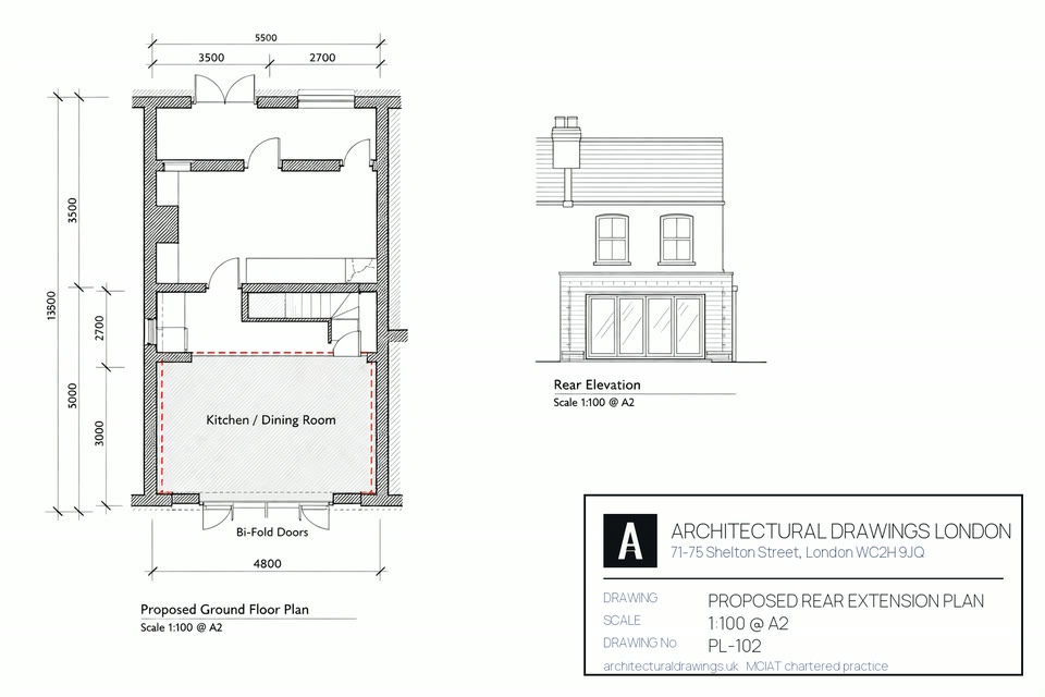
The planning set that goes to the council through the Planning Portal: proposed elevations, plans, and the OS location plan with your site outlined.

Found this useful? Share it

Copies the headline and the link, ready to paste anywhere — helpful if you are planning an extension with a neighbour, builder or architect.

Free quote in 60 seconds
Call us Free quote →

Before you go…

Get a free, no-obligation quote for your project. MCIAT chartered.

council-ready drawing review · All 33 London boroughs